Lucka 16: Gmok goes global
Vi lämnar över ordet till Robbie direkt:
Orienteering in Canada
Hello everyone! Sorry for writing this in English, but I haven’t gotten as far in my Swedish as the other ‘global’ runners. 🙂
My name is Robbie Anderson and I come all the way from Ottawa, Canada. I came to Göteborg in late August to pursue a two year Masters program at Chalmers in Environmental Engineering. After finishing my Bachelors degree at home, I wanted to continue studying in a new environment with good orienteering possibilities. The program at Chalmers and the orienteering possibilities in Göteborg seemed like the perfect combination. I’d like to thank GMOK for the warm welcome and the excellent opportunities in these first few months. Below is some information on orienteering in Canada along with some interesting maps from all across the country.
I started orienteering at a young age with my parents with the Ottawa Orienteering Club. It is one of the biggest clubs in Canada with around 200 members, however only 50 or so are very active. When you consider that Ottawa has a population of around one million, you realize how small the sport is in Canada compared to Sweden. There are around 25 clubs in total in the country, however some are extremely small.
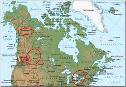
One of the major challenges for orienteering in Canada are the large distances separating most major clubs around the country. The main orienteering centers in Canada can be seen in the map below. It is very common to drive a long ways to get to weekend events. I would usually make a few trips down to races in the Toronto area (5hrs) or in southern New York State (10hrs) in the spring/fall each year. To get across the country from Ottawa to Vancouver requires a 5 hour flight at a hefty price tag.
Main orienteering centers in Canada.
The biggest competition each year is the Canadian Championships (COCs), which usually attracts around 300 entrants. The North American Championships are held every two years and may see over 500 entrants. At local meets across Canada, a turnout of 50 people would be considered a success.
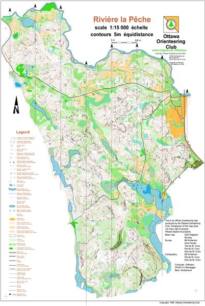
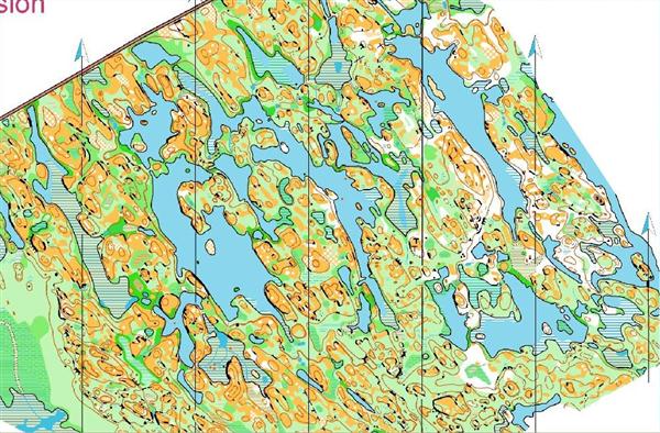
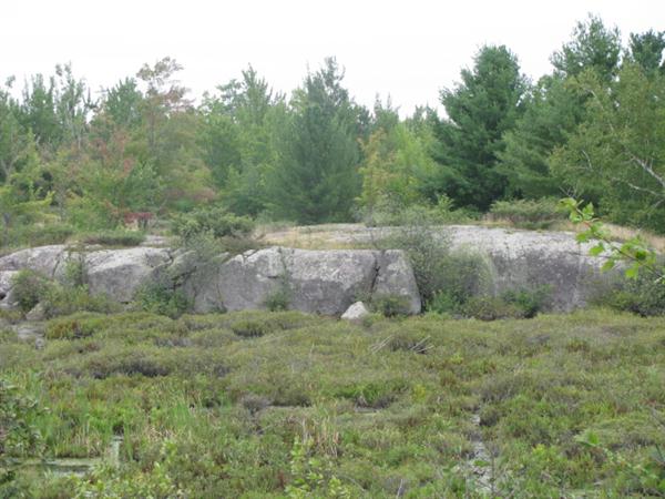
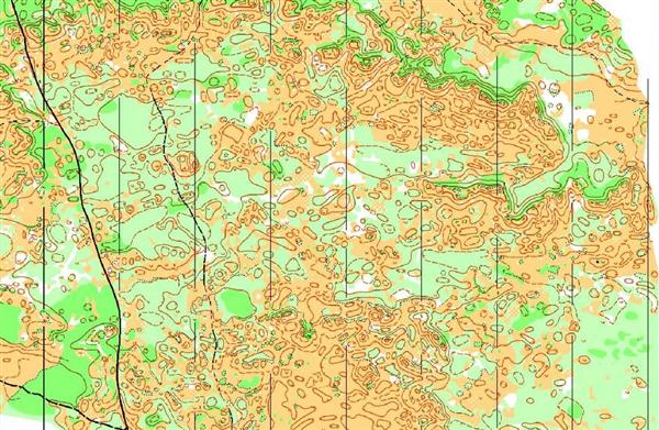
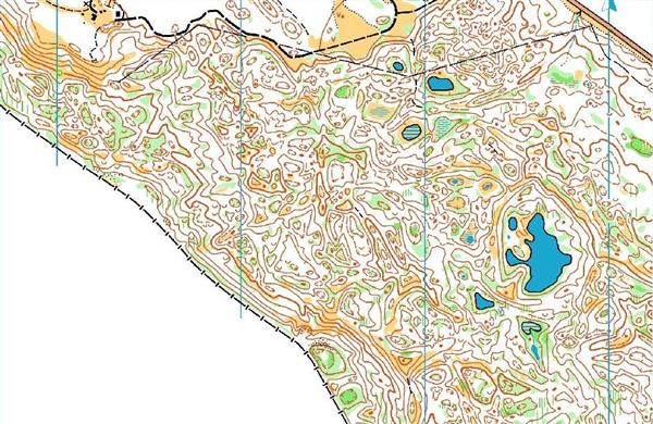
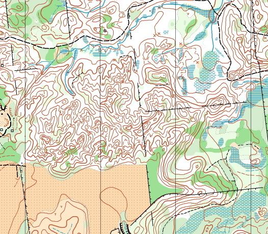
The terrain around Ottawa is quite varied. We have a large National park north of the city which has very hilly and rocky terrain (Map 1), however south and west of the city is quite flat. Some of the terrain in the flatter areas (Map 2), which we call ‘Scandi-tario’, somewhat resembles Swedish terrain.
The terrain across the rest of the country also varies significantly. The prairies in Central Canada, the mountains in the West and North, and Southern Ontario all have completely different terrain. This can hopefully be seen from the maps I’ve selected below.
If you are interested in looking at many more Canadian maps you can check out the Canadian Routegadget page at: www.orienteering.ca/events/routegadget/
Maps from Home
Rivière La Pêche, Gatineau Park, outside of Ottawa.
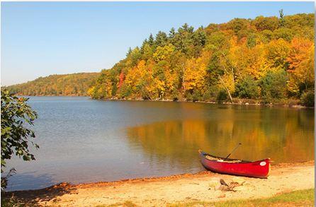
Rivière La Pêche, Gatineau Park, outside of Ottawa. Photo: J.Holden, 2011
Carp Ridge ‘Barrens’, outside of Ottawa. Used for the 2010 Canadian Championships.
Carp Ridge ‘Barrens’, outside of Ottawa. Photo: S. Bergström, 2010
Other Maps from around Canada
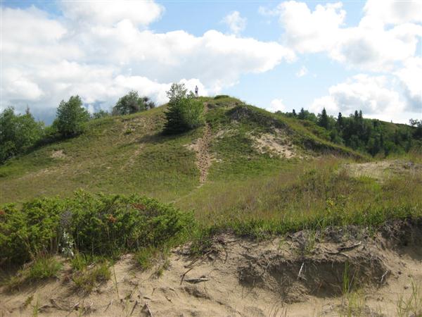
Hog’s Back, Manitoba ‘Sandhill’ terrain. Used for the 2009 Canadian Champs.
Hog’s Back, Manitoba ‘Sandhill’ terrain. Photo: MOA, 2009
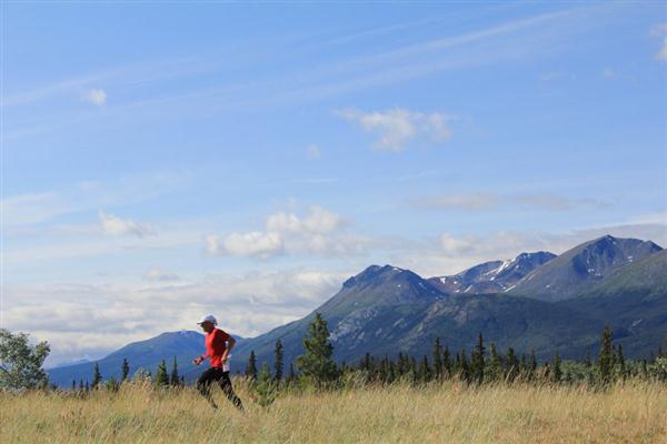
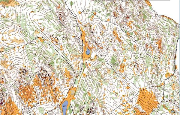
Lewes Lake, Yukon. Used for the 2011 Canadian Champs.
Lewes Lake, Yukon. Photo: A. Zissos, 2011
Cranbrook Community Forest, British Columbia. Used for the North American Championships 2010.
Mineral Springs, Hamilton, Southern Ontario.
Tack för ett intressant och välskrivet reportage!
——————————————
Denna nyhet är importerad från gamla hemsidan.
Författare: Mikael Eliasson
Länk till originalnyhet: old.gmok.se/News/Details/735.
“Scanditario” ser bra läcker ut!
Thanks Robbie!
Sjukt fina kartklipp! Grymt beskrivet. Tack Robbie!